Despite the undoubtedly hefty price tag, the Oregon 550T is a rugged and robust machine that combines very effectively its basic navigation function with the ability to take and store pictures, cleverly geotagging each photo with the location of where it was taken. For the committed climber / hiker or for those wanting to upgrade to a higher spec GPS machine, this model is a serious piece of kit that deserves careful consideration.
Getting your bearings
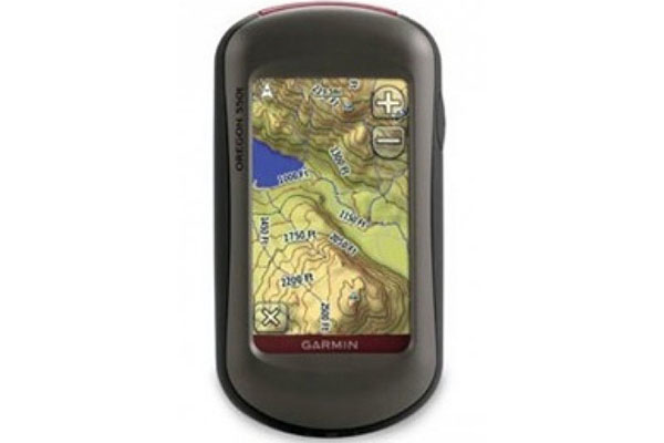
 Like the other models in Garmin’s extensive range , the Oregon 550T proves supremely reliable and precise in quickly locating your position, even in areas of dense tree cover or within built-up urban landscapes thanks to its high sensitivity WAAS-enabled GPS and “HotFix” satellite connection. Unlike lower spec models however, it also boasts a 3-axis tilt compensation compass which will show your direction accurately without the need to hold it level, and even while standing still.
Other useful additions include the barometric altimeter which can track changes in pressure over time enabling you to keep an eye on the ever changing weather conditions and pinpoint your precise altitude, and the 3D elevation view which helps you visualise the contours on topographic maps making it easier to judge just how steep that hill really is!
Useability
The build quality is excellent. It feels good and sturdy in your hand and comes with a useful carabina clip so you can securely attach it to clothing or a rucksack. It can survive being dropped and bumped about, and being fully waterproof, can withstand accidentally being dropped in up to a metre of water or survive a flooded tent!
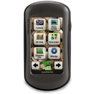
It has a very responsive 3 inch colour touchscreen which is easy to operate once you have become accustomed to the menu system. Screen brightness has been significantly improved from the previous 400T version and the only point that can be levelled against it now is the amount of reflection you get on the screen in bright sunlight. This can usually be overcome by careful angling of the screen, but can prove problematic if you are trying to share the screen with a companion.
The unit runs on 2 AA NiMH rechargeable batteries which, along with the charger, are included in the package. Garmin advertise the life of the batteries as 16 hours which might be fine if you are only using the basic functions. Use of the compass and camera however will reduce this to about 6 / 8 hours, so it is worth thinking about buying extra sets of batteries to keep you going.
Digital camera with automatic geotagging
The feature that really makes this model stand out however, is the incorporation of a digital camera which automatically geotags each photo to the exact location of where it was taken. Far from being a gimmicky add-on, this strikes me as a really useful extra feature that opens up a realm of new possibilities.
The 3.2 megapixel autofocus camera with 4x digital zoom is set in the back of the unit (similar to the set-up on mobile phones) and takes a reasonable quality picture even in poor light conditions. Stored photos are displayed on the installed topographic map of where the photo was taken, enabling you to mark and remember the exact location, and navigate back to it at any point in the future.
Photos can be taken in landscape or portrait format, and the 850MB of internal memory provides ample storage space. Additional storage can be gained through the use of a micro SD card, and connection to my.garmin.com via USB allows access to “Picasa”, a popular online community where you can upload and share your photos.
Maps
The Oregon 550T comes preloaded with a 3D worldwide basemap, with shaded relief, along with what Garmin term a “recreational” map of 29 countries across Europe. This includes points of interest such as hotels, restaurants and pubs, and at 1:100,000 scale the map detail is easy to read, including terrain contours at 100m (328ft) intervals.
However you will almost certainly want to buy extra, more detailed maps for the specific area you want to explore. Garmin’s GB Discoverer maps available as a microSD card can easily be plugged in giving you street mapping, marine mapping or topographical maps at 1:50,000 scale. At around £120 per map this is a significant extra cost that needs to be factored in, but once installed you have the advantage of intelligent navigation on your touchscreen and can go paperless with confidence.
Geocaching / Whereigo capability
Downloading information from geocaching.com direct to the Oregon 550T is simple via an app that is included, making it easy to go paperless while still having valuable information about location, terrain, hints and descriptions at your fingertips as you go. Simply download a plug-in from Garmin (listed in the manual) and then connect the 550T to your computer. The machine’s 3D elevation view can prove invaluable in helping you visualise the terrain of where you will be exploring before you get stuck in, and with a memory of 2000 geocaches, the geotagging function for your photos is an obvious plus point.
Also compatible with whereigo via their website.
Wireless data transfer
Sharing information with other Garmin users is made simple. Just touch “send” to transfer your information directly to other Oregon, Colorado, Dakota and Foretrex devices, or connect to Garmin Connect to access this online community where you can analyse, categorize, and share data.
In summary
The Oregon 550T is a rugged, reliable handheld machine that does what it claims to very effectively. The obvious downside is of course the cost- not only of the unit itself, but the inevitable add- ons in terms of additional maps and extra batteries. That said, for those who are serious about their outdoor pursuits and are prepared to make an investment in a serious piece of kit, then the Oregon 550T has a lot to recommend it.
DETAILS
- 3.2 megapixel auto-focus digital camera with automatic geotagging
- 3-axis tilt-compensated electronic compass and barometric altimeter
- High speed USB for faster map and photo transfers with your computer
- Improved 3-inch sunlight-readable colour touchscreen display
- 850MB of internal memory for map data and photos